Rumtse to Tso Moriri trek is a popular trekking route in the Ladakh region of northern India. This trek takes you through the remote and picturesque landscapes of Ladakh, offering stunning views of mountains, high-altitude lakes, and traditional Ladakhi villages. The trek usually starts from Rumtse, a village located about 70 kilometers southeast of Leh, and concludes at Tso Moriri Lake. This trek typically takes around 8 to 10 days, depending on the specific itinerary and trekking pace. The trek involves high altitudes, and it’s essential to acclimatize properly to avoid altitude sickness. Tso Moriri Lake itself is located at an altitude of over 4,500 meters (14,800 feet).
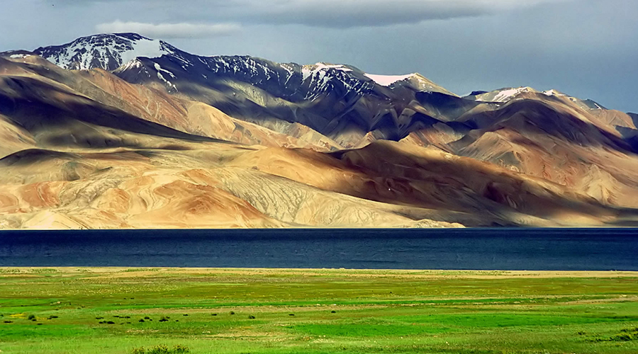
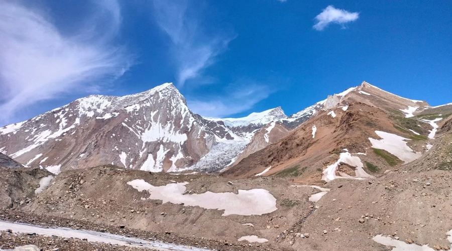
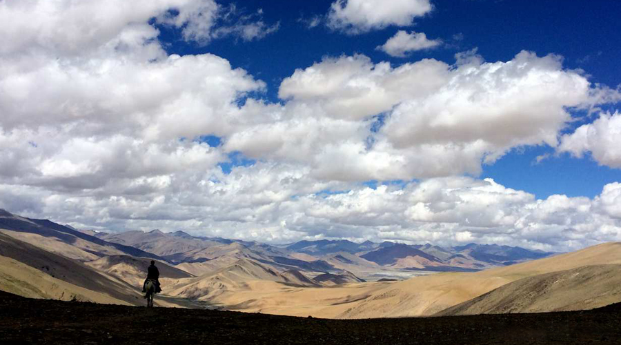
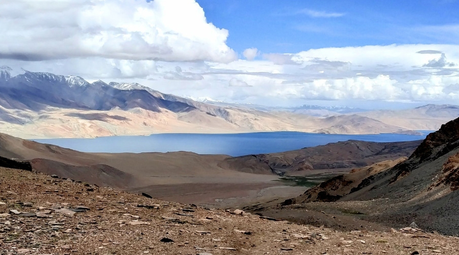
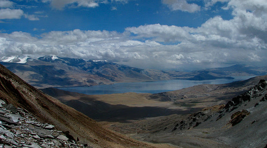
Rupshu Valley lies sandwiched between Ladakh in the north, Tibet in the east and Zanskar in the west. It is a part of the Changthang plateau and is characterized by high arid plains, remote villages, snow-capped peaks and beautiful high altitude azure-blue lakes, the largest being Tso Moriri at 4.500 m. The region is accessible only for a few months every summer and is inhabited by Changpas – nomadic yak and pashmina goat herders of Tibetan origin, who wander this area crossing over high altitude mountain passes. Our trek takes us across these passes to their summer settlements to witness a unique human culture, far away from the reaches of the modern world. The scenery is wild and vast with snow capped peaks lining the far horizon and the area is also home to some rare wildlife like Kyang, Blue sheep, Ibex and the famous Himalayan snow leopard. The final part of our trek leads us over a high mountain pass to the shores of beautiful Tso Moriri Lake. Surrounded by over 6,000m high snowcapped peaks, this lake is alive with an abundance of very rare migratory birds. The trek ends at the enchanting Tso Moriri and from here we can transfer to Leh or continue to Kibber in Spiti (see Tosmoriri-Kibber).
Today is the first day of the trek. Start by walking down the Leh-Manali highway, towards Manali. Walk for 1 km from the Rumtse village. Take the trail towards your left, pass by the Jammu & Kashmir Tourism lodge and hike alongside the Chhaba Chu stream, which will flow on your left. After 10 minutes you will come across a steel bridge. Cross the bridge with the stream on your left and keep left, along a small plateau.
The dusty trail will eventually take a U-turn as you leave Chhaba Chu and enter Kyamar valley. This point is the confluence of Kyamar stream and Chhaba Chu. Leaving behind Chhaba Chu, look for multiple rivulets. These are small streams and can easily be crossed.
After a few minutes walk from the Campsite the ascent of Kyumur-la (Kyamri-la 5.180 m)starts its easy but very long way to reach the top. There beautiful flowers on the way. From the top of the pass the trail divides into two one goes to your left which leads towards Tsokar but one day longer. You can take the trail falls on your right, which goes down to the stream and start climbing another pass across the stream. There is no trail to be seen for sometimes but after few minutes a clear trail leads you to the top of Mandalchan-la(4996m). The trail goes further up and then steep down to a beautiful area called Tisaling. Pitch your tent here.
Today you have to cross Shibuk-la (5.130m)a near the camp site. There is hill saddle, so you have cross right saddle. As soon as you come on the top of the pass you can have view of Tsokar Lake. Walk down the to the Tsokar Lake through an easy descent to the Lake, as soon as you finish the gorge walk from the hill as the campsite is just behind the hill.
Today it’s an easy walk along the Lake. Walk towards east through the motorable road and take the same direction from the end of Stupa along the road. After sometimes you can have view of agriculture field. And the Campsite is just next to the field near the river.
An easy ascend to the pass takes around 1 hours 30 minutes. The trail turns towards north-east just after the pass through a valley. The camp site is across the river at the base of the pass.
Start climbing the Kyamayur-la (5125m) which takes around 2 hrs at average speed. The last climb is the tiring one. After the pass the trail leads towards north-east and at the end of the valley trail starts ascending another small pass called Gyama La (5100m) from where you can have views of Peaks. Walk down towards north-east and cross the small river and the Gyama lhoma is reached after another river crossing which is also a base for Krzok pass.
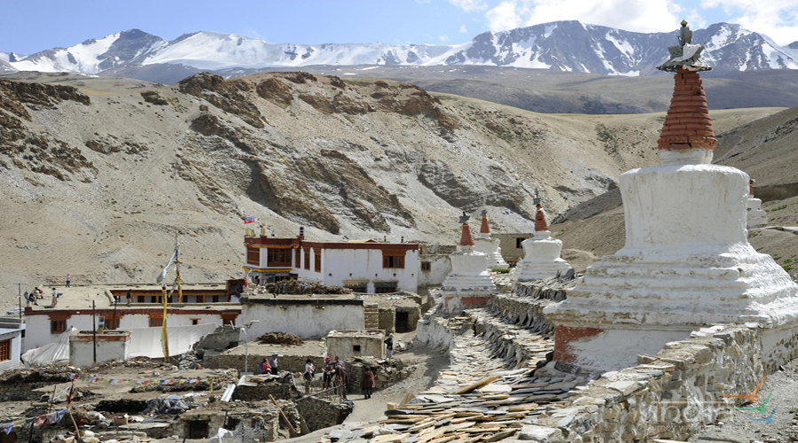
Start an easy ascent to the Korzok pass along the stream. It takes around 2 hrs to reach the top from where you cab have the wonderful view of the Lake. Then steep down to Korzok village. You can also camp at Korzok Phu where nomad camps are located, around one hour before the lake if you have extra days.

Local English speaking trek guide
All ground Transport

Cook and Helpers

Breakfast, lunch, dinner Plenty of tea, coffee

...

Two men tents for sleeping Kitchecn Tent / Dinning Tent / Toilet tent / Mattress

Camping fee Wild life fee

Oxygen cylinder / Rope / First Aids kits

All Kitchen Gears

Any

Lorem ipsum dolor sit amet

Lorem ipsum dolor sit amet

Lorem ipsum dolor sit amet

Lorem ipsum dolor sit amet
Copyright © 2026, Active Adventure | Developed By AlgoPage IT Solutions Pvt. Ltd.