Tso Moriri to Kibber typically refers to a trekking route in the Indian state of Himachal Pradesh, within the Ladakh region. Tso Moriri is a high-altitude lake located in Ladakh, and Kibber is a village in the Spiti Valley of Himachal Pradesh. The trekking route between these two points offers breathtaking landscapes, remote villages, and a chance to experience the unique culture of the region.
Please note that trekking conditions, routes, and regulations may change over time, so it’s crucial to check for the latest information before planning your trek.
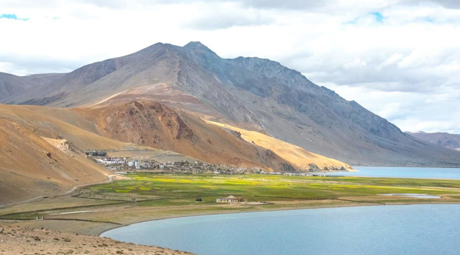
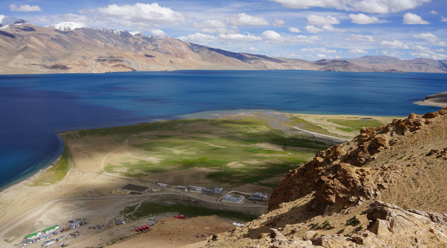
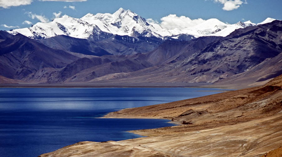
After well acclimatised in 3 to 4 days you will start this trek from Leh 3505 m (11.499 ft) drive to Tso Moriri Lake 4530 m (14862 ft). It takes you 7 to 8 hours. Driving along the Indus valley you will pass by very nice scenery. On the way you see the Lake Tarsang Tso. The village Korzok is situated on the Lake Tso Moriri. In Korzok you can visit a monastery or climb a hill. On the top of the hill there is an amazing view over the lake. You spend the first night at the camping ground near the lake.
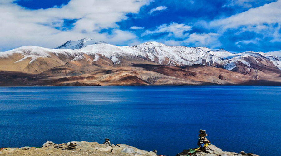
The first hiking day iseasy, just trek along on the shore of the Lake till the southern edge of the lake. That means that you keep the altitude for the whole day (no ups and downs). Being at 4500 m the hole day and night is a very good preparation for the high pass on the 6th day of the trek. On your way you will see many birds. There is a good campsite on the lake called Kyangdam at 4530 m (14862 ft).
Follow the shore of the lake till you finally reach a river delta. From there on its only 2 more hours till you come to Nurboo Sumdo (4530m) where you will stay overnight.
After a short walk you have to cross the river several times. It is very important to cross the river in the morning otherwise the water level is too high. The hip deep water is quite cold as it comes straight from the glacier you will cross the other day. Sandals are highly recommended. After crossing the river you can warm up your frozen feet during a walk along the river uphill. You will be rewarded with amazing views over the river. Enjoy the beautiful rock scenery formed by the power of water and wind. On the way you see two 6000er mountains. Your camping ground is on the river 4.635 m (15.206 ft).
Go further up that valley until you reach the end of the valley. After final crossings of the river (probably not so often and deep as yesterday morning, anyway sandels are recommended) you reach a very nice camping ground. That is surrounded by many snow capped mountains. From here you see the target of the next day Parang-La with its magestic glacier.
Option: You can split this 1 day stage in 2 days stages by camping in Tharang Yogma.
That is the longest and hardest day on the trek. There is another river crossing in the morning. Follow the pass on the left side of the glacier (and cross the river) up to 5.400 m. You cross the glacier for approximately 1.5 hours until you reach the pass of Parang-La 5.578 m (18.300 ft). That means walking on a mixture of ice and snow and you feel like you will never reach the end.
There is an amazing view all the way back and a completely different landscape on the other side of the pass. Going down the steep path you might think: “Thank you for not having to climb it.”
Follow the path until you reach a narrow gorge with a river (first water supply after the pass). Follow the river for 1.5 hours (several river crossings are necessary) and climb a side valley for 200m until you reach the camp side Tangltak 4.515 m (14812 ft). Tangltak is the first campsite with water supply. That makes it a very long day trek.
After that hard day yesterday the last day is a very easy and short. Climb a small pass for about 30 minutes. At the left you can enjoy the view of the snow capped mountain Shilla (7.026 m). Follow a broad green valley until you see the first village after a couple of days. Go down a gorge to the river and climb up for about 200 m till you reach the prosperous looking village Kibbar. Here you can find a few new guest houses. From here you can visit the Key monastery.

Local English speaking trek guide
All ground Transport

Cook and Helpers

Breakfast, lunch, dinner Plenty of tea, coffee

....

Two men tents for sleeping Kitchecn Tent / Dinning Tent / Toilet tent / Mattress

Camping fee Wild life fee

Oxygen cylinder / Rope / First Aids kits

All Kitchen Gears

Lorem ipsum dolor sit amet

Lorem ipsum dolor sit amet

Lorem ipsum dolor sit amet

Lorem ipsum dolor sit amet

Lorem ipsum dolor sit amet
Copyright © 2026, Active Adventure | Developed By AlgoPage IT Solutions Pvt. Ltd.